
Brunswick River Kayak Trip
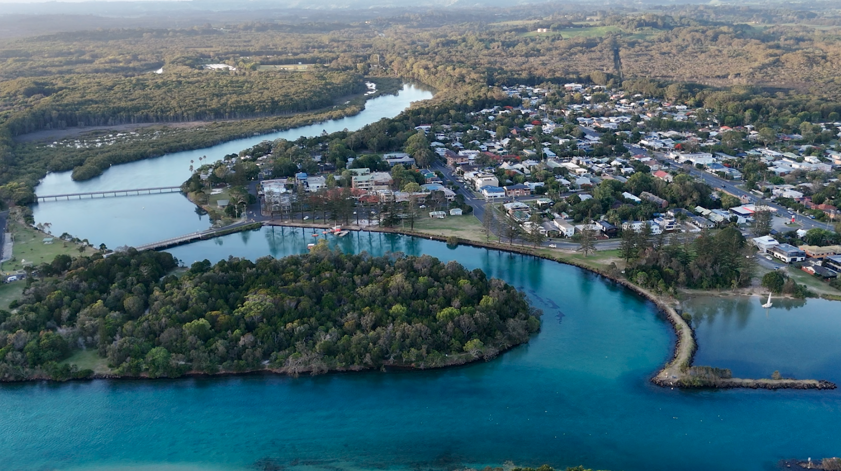
- Tweed St, Brunswick Heads NSW, Australia
- www.brunswickheads.org.au/tours-activities/boating-kayaking/self-guided-kayak-trips/p/214
This self-guided paddle can be structured either as a 10km one-way journey or a 20km return trip.
Suggested launch sites:
- End of Tweed St – beach east of Massey Green Caravan Park
- Mona Lane end of Memorial Park beach
- Boat ramp at the Fishermen’s Co-op (can be slippery)
- Ramp at Ferry Reserve
- West of Ferry Reserve Caravan Park at Riverside Cr
Paddle west towards and under the bridge that carries the new Pacific Highway over the river. Shortly after the bridge is Mangrove Island. The deeper water is to the left, but a kayak or canoe can usually pass either side.
The scenery is excellent and you’ll see many species of birds along the way. There are several opportunities to view Mt Chincogan and the Nightcap National Park Range. Most of the land along the main arm of the Brunswick River is privately owned, therefore customary access protocol is suggested.
There’s really only one place where you could make a wrong turn and that’s where King’s Creek meets the river. This junction is approximately half way to Mullumbimby. Keep right to continue to Mullumbimby. As you get closer to town, you will pass under an historic railway bridge. This is part of a railway line from Casino to Murwillumbah that opened in 1894.
You will know you have reached Heritage Park when a small dirt boat ramp appears on your left. This is the more tranquil end of the park, but it is worth noting that the toilets are closer to another boat ramp at the far end, near Federation Bridge. Over 200 species of rainforest plants have been established and labelled in Heritage Park, providing an opportunity for an impromptu botanical lesson. A 10 minute walk into town will take you to cafes for a drink or bite before the return trip home.